
This past weekend, we ended Dr. Chris’s birthday week celebration with an ascent up Mt. Shavano, at 14,229′ (4337 m). We didn’t make it to the summit of the neighboring Tabeguache Peak, but I’m including it in the title of this piece because it was very much a part of our experience on this particular trek.
The standard summer route up Shavano and Tabeguache starts at 9700′, outside of the town of Salida. Up to the summit of Shavano, there is a 4400′ elevation gain over about 4.2 miles. If this is hard for you to imagine, know that it is formidable. Additionally, the trail increases in difficulty the further you progress, and the last .6 mile to the top is one of the most challenging ascents I’ve ever done without a heavy pack. In a previous article, I mentioned anticipating an inner dialogue about turning around before summiting. This inner dialogue didn’t involve me turning around so much as just passing out on a rock and staying there forever. But I did manage to summit after a 5.5 hr ascent, which included a 2-mile detour past and then back to the very first sign indicating the trail, in the dark of the early morning, at the very beginning of the hike. As obvious as the sign should have been, I’m relieved to say we weren’t the only ones.

And this is precisely why you should bring several resources to help guide you. In spite of all the trail descriptions with mileage that we brought, the only sure indication we had passed the turn-off from the Colorado Trail were the actual GPS coordinates of the sign listed in one of our resources (14ers.com). Pro tip: you can enter GPS coordinates into your Google Maps app (assuming you have service); leaving off the capital letters for cardinal directions (N, S, E, W), the first number will be latitude, the second longitude (in our case, we entered “38.60218, -106.19594” to find the sign we had initially passed).
Another learning experience on this particular trek was regarding our camp site. We had chosen the Angel of Shavano camp site, close to the trailhead, which is outside the town of Maysville, past Salida (about two hours from Frisco). The site is right at the foot of the mountains in that area, quite small (20 spots, first-come-first-serve, $20 per night for two vehicles). I was expecting a lot of other hikers, going to bed earlier than us, to wake up and start their ascent earlier than us, with more expensive, specialized gear, but was surprised to find all our neighbors partying until hours after we had retired into our tents.

As it turns out, there is a Winter route up Shavano, and the trailhead for the standard Summer route was about a 30-minute drive back toward Salida from the Angel of Shavano campground. So that explains why we didn’t encounter any other early-risers there. The good news is that Angel of Shavano campground is gorgeous, right off the Colorado Trail, along a beautiful river that, this late in the summer, was flowing shallow and slow enough that I could set a chair in it and soak my feet in the icy water (before putting them through hell the next day).

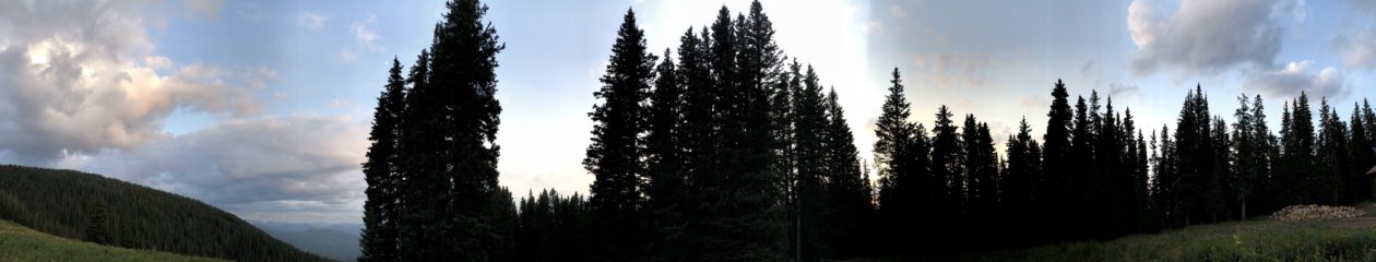
We ended up at the trailhead for the Summer route the next morning at 5:15 am. Pitch black. Here’s another pro tip: if your headlamp is dim, it needs new batteries.

Other than missing what would have been a very obvious sign in the daylight, the rest of the trail was pretty much straight up. Even the switchbacks were steep enough to make me think, “Would it be much steeper if we just went straight up?” If you’ve ever climbed Peak One in the Ten Mile Range above Frisco, it’s like that (or any portion of that) times a hundred.

It’s also significant to note that this was the second time in my life I’d ever wished for hiking poles. The steep grade had me pushing off my own thighs constantly as I trudged up the incline, and my quads were burning the entire hour-and-a-half it took me to get back down. Yes: 5.5 hours up, 1.5 hours down.
The water in my Camel-bak was all I’d brought on the trail (after drinking from a couple Nalgene bottles I’d brought in the car), and I ran out just before getting back to the trailhead. One of us ran out of water in her Camel-bak on her way up to the summit. Fortunately, another one of us had packed an extra gallon of water.
As far as snacking went, we had plenty of jerky, pistachios, bananas, nut butter, and electrolytes between us. I may even have had a chocolate-covered Twinkie. But we didn’t finish all of that, and as I’d expected, my body didn’t really crave food so much as liquids, until I’d reached the end of the hike, at which point I promptly finished all traces of food in the car.

All-in-all, I’d say that was a successful excursion, and even the mistakes we made affirmed that even experienced hikers should take extra care. My main takeaway: don’t rush the start of the trail. It is worth hours to be sure where you are headed, even if it means standing in one spot, double-checking all your resources, entering GPS coordinates for 20 minutes.

Also notable: we started back on the right track toward the beginning of the hike just before 7 am, at which point it was already bright out, and I reached the summit at 11 am. By 11:15, all the distant clouds had amassed into huge thunderheads, and the first rumble of thunder had us packing up pretty quickly. And this isn’t the first time I’ve seen this. No matter how far away you think those clouds are, it takes mere minutes for them to travel. And as white and interspersed as clouds may seem, they can collect into large, grey, stormy masses very quickly. So, beer in hand, I started a quick descent from the peak. I’d already run for my life down a fourteener in a lightning storm once, and I don’t ever plan to do that again. Furthermore, the summit area of Mt. Shavano is little more than a huge pile of rough boulders, a type of terrain requiring your hands as well as your feet to navigate, called talus. The trail is neither clear nor safe, and there is no way you are running down it.

Neither did we.
Finally, the weather was the main reason we didn’t make it to the neighboring Tabeguache Peak. A local we talked to on the trail who had made the ascent numerous times advised us to budget at least an hour each way to and from Tabeguache. It’s only about a mile away, but it’s a rocky, narrow ridge. And sure enough, on our way down, it started hailing along with the thunder (and in my experience with fourteeners this time of year, it always does), rained lightly twice through the forest, and then poured torrential rain toward the bottom of the trail.
Would I recommend this trek? Definitely. It is a true test of fitness, and even more so, stamina. As with any other trek, and as I always strongly advise, be wise and pre-emptive about how far and how fast you go. Elevations above 8,000′ are when your body’s reaction to the altitude become exponentially more dramatic, so you can bet elevations above 10,000′ put you at much higher risk for all kinds of symptoms of altitude illness. The faster you ascend, the greater the risk. And remember, our party set out well before daylight at 5:30 am. In the future, should I plan to summit both of these beasts, I would certainly start no later than 4 am.
Other than that, do your homework and prepare accordingly, and you’ll be in for the time of your fitness-challenging, self-motivated lives! Happy Trails!


Roberto Santos is from the remote island of Saipan, in the Commonwealth of the Northern Mariana Islands. He has since lived in Japan and the Hawaiian Islands, and has made Colorado his current home, where he is a web developer, musician, avid outdoorsman and prolific reader. When he is not developing applications and graphics, you can find him performing with the Denver Philharmonic Orchestra, snowboarding Vail or Keystone, soaking in hot springs, or reading non-fiction at a brewery.

Hi Dr. Ebert-Santos.
I stumbled across your site after it turned up in a Google Scholar search. I enjoyed reading about your adventure up Mt. Shavano.
I’d like to invite you and Mr. E-S to become members of the Altitude Acclimatization group on Facebook. There are currently about 4,500 members. It might be a good way to reach a new audience with your suggestions for acclimatization.
best regards,
Kenny Meyer
Oooops…I forgot to leave a link.
Facebook Altitude Acclimatization Group: https://www.facebook.com/groups/AltitudeAcclimatization/
Wonderful, Kenny! Thanks for sharing!