Beyond Acclimatization: Avalanche Safety

Spring of 2019 in the Colorado high country has certainly been one to remember. Unsure of where work would take me, I waited until the last week to commit to a ski pass for the season, and after all the storms we’ve seen, I’m glad I did. And I can tell that many others are just as excited. I’ve never seen so many people on the weekend slopes and on the surrounding highways.

Meanwhile, the central mountain region has seen a record number of avalanches and fatalities, and Colorado retains the highest statistics in the country. People from all over the world come for world-class skiing, but many experienced locals have been avalanche victims. We often assume they are skiers and snowboarders, but avalanche fatalities happen just as often to snowmobilers and backcountry hikers. Another misconception is that these avalanches are happening exclusively in the backcountry, which they are not. Three young men this year barely escaped an inbounds avalanche at Breckenridge ski area, while two weren’t so fortunate in New Mexico’s Taos Ski Valley.

But the wild Colorado backcountry still beckons and many continue to answer. Having spent over ten years in Summit County, home to Colorado’s greatest number of peaks over 14,000 ft., my family and I are regulars in the backcountry, in all seasons. Experiencing these mountains in all kinds of conditions can make you much more aware of the risks inherent in the outdoor recreation scene here, but it clearly does not guarantee your safety.

This coming April, I’ll be on a trek to one of the 10th Mountain Division huts, a series of remote cabins, most of which are only accessible by foot, snowshoe or ski. In the summer, the trails tend to be well-maintained and obvious, but I’ve seen first-hand that conditions in snow, even during a mild season, can make the commute much more difficult and much more dangerous. Carrying all your supplies on your back certainly increases your vulnerability and decreases your ability to respond quickly to unexpected events, as you are more liable to sink deeper into loose snow-pack.

Shrine Mountain Inn, one of the more easily-accessed huts in the 10th Mountain Division system, even offers running water and electricity, as is within most cellular networks.

As you may have been taught, luck favors the prepared. If there’s one way to tell a local from a visitor in the high country here, it’s how prepared they are to be outdoors in variable conditions, and as the sole resident on the upcoming hut trip, I will be passing on all the proper safety precautions to my less-experienced San Francisco counterparts.

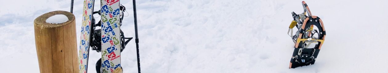
Expeditions to more popular huts at lower elevations during mild winters tend to be more about preparing comforts: boots, snowshoes, skis that fit well; warm, dry layers; plenty of water; etc. What makes me especially wary of the increased danger and the necessity of avalanche equipment is the alternating warm weather and snow storms. This means several alternating layers of heavy snow and light pack, making large slabs of snow (and ice) more prone to letting loose and leveling everything in their way.

While there are some obvious measures you can take and gear you can pack to boost your ability to respond in case of an avalanche, professionals across the state can’t recommend official avalanche safety certification highly enough. It’s available across the globe, thanks to the American Institute for Avalanche Research and Education (AIARE), and Colorado is one of the best places to get certified.

Technology has come a long way when it comes to avalanche safety, but the three things AIARE recommends you carry while in the backcountry are a transceiver (a beacon), a probe (for finding buried victims) and a shovel. Local conditions are updated daily on Colorado’s Information Marketplace Avalanche Information Center. Be sure to check the very day you plan to be in areas of high risk, and as frequently as possible.

On a closing note, keep in mind that avalanche safety measures aren’t always as intuitive as carrying a shovel. One major statistic we should all keep in mind is that most avalanches don’t happen on their own, and are caused by the victims themselves, often because there is more than one person traversing a slope at a time. In this case, safety is not in numbers: one person on a slope at a time.

I love Colorado, I love the mountains, I love the ski slopes, I always appreciate the vast open wilderness of the Rockies, and I’m looking forward to many more upcoming excursions in them. Hopefully this has armed you with some knowledge to better equip your daring high country adventures. It is just the tip of the proverbial ice berg, however, and on top of certification and gear, there is no end to the value that actual experience adds.

Roberto Santos is from the remote island of Saipan, in the Commonwealth of the Northern Mariana Islands. He has since lived in Japan and the Hawaiian Islands, and has made Colorado his current home, where he is a web developer, musician, avid outdoorsman and prolific reader. When he is not developing applications and graphics, you can find him performing with the Denver Philharmonic Orchestra, snowboarding Vail or Keystone, soaking in hot springs, or reading non-fiction at a brewery.

A Sea-Level Dweller Climbs Cotopaxi

During the winter of 2018, the Little Rock Climbing Center Alpine team ventured south to Ecuador for a mountaineering expedition. However, poor weather and high avalanche risk thwarted our summit attempts of Cayambe (18,996’, 5789 m) and Cotopaxi (19,347’, 5896 m). This winter (2019), we returned to Ecuador to attempt to summit Cotopaxi again, with a new and improved acclimatization plan and high hopes for better weather. Little Rock, AR sits at a mere 335 ft (102 m) above sea level … but we are lucky to have Pinnacle Mountain, with 750’ (228 m) of elevation gain to train on. A small mountain is better than no mountain!  My training plan entailed hiking Pinnacle Mtn 2-3 times during the week, and then hiking or mountain biking on the weekend for approximately 3 months. I also rock climbed at the climbing gym 2 days a week, but Cotopaxi is not a technical climb, so that was mostly for fun.  I took a week-long trip out to Colorado in September to reassess how my body reacts to high altitude.  During this week we rock climbed in Boulder Canyon, Idaho Falls, and climbed the first and second Flat Irons, as well as hiked up to Sky Pond at Rocky Mountain National Park, hiked Mt. Bierstadt, and hiked out to Crystal Mill with Dr. Chris. I chose not to run too much this year for training because I have a meniscal tear in my left knee that gets aggravated on long runs. 

We arrived in Quito, the capitol of Ecuador on December 30. Quito sits at 9,350’ (2849 m), so we took our first day pretty easy, and walked from our hotel to the older part of town with historic churches and cathedrals. Walking up the many flights of stairs in the Basilica del Voto Nacional got my heart pumping and legs and lungs burning! New Year’s Eve in the La Mariscal area of Quito was quite entertaining and a little rowdy, with fireworks, burning of effigies, and jumping over the fires. Our first day hike was up Rucu Pichincha (15,413’, 4697 m), a stratovolcano right in Quito! The TeleferiQo (a gondola) brings you up to 12,943’ (3945 m) where you begin the hike. The hike up Rucu Pichincha starts out mellow, on smooth trail with short steep, punchy climbs. Once you near the top, the steepness increases and the last few hundred feet involve very easy scrambling on sharp volcanic rock. The winter in Ecuador is typically the rainy season, so scattered showers and electrical storms are very common. However, we lucked out with perfect weather on Rucu Pichincha, and fantastic views of the big mountains – Cotopaxi, Antisana, and Chimborazo. The next day we drove to the base of the Ilinizas, and just missed the horse that was supposed to carry our packs up to the refugio. It was about a 3,000’ (914 m) climb up to Refugio Nuevos Horizontes, in relentless wind and dense fog. About half way up to the refugio, a lone figure emerged out of the fog. The horse that was supposed to carry out gear was carefully making his way down the mountain, such a surreal sight! We spent the night sharing bunk beds, packed like sardines in the tiny refugio (15, 696’, 4784 m). The next morning, the wind hadn’t let up, and the fog was still suffocatingly thick. A few groups had attempted an early morning ascent of Iliniza Norte, but said it was too icy and windy to summit. Our mountain guide, Alejo, suggested we traverse around the backside of Iliniza Norte to avoid the worst of the wind, and his advice was on point. The wind was whipping so hard at the summit (16,818’, 5126 m), we spent less than 5 minutes on top before beginning our decent back to the car. The wind was so strong on our descent (upwards of 60mph!), it knocked me off my feet several times. Next time I will use my hiking poles when it is so windy! We spent the next day resting and recuperating at Los Mortinos Hacienda, a cozy B&B at the edge of Cotopaxi National Park where we watched llamas graze, went horseback riding, and dined on fresh trout from a nearby river. 

The next day we drove up to the Cotopaxi parking lot, and slogged up the soft, ashy trail for an hour or so before reaching Refugio Jose Rivas (15,744’, 4798 m) at the base of Cotopaxi. At the refugio we ate some dinner, hydrated, and then tried to rest as much as possible. Alejo woke us up at 10pm and by 11pm we were on our way up the volcano. The skies were finally clear and calm after days of clouds and windy weather, all of the stars were out and we watched an impressive lightning storm down in Quito. We began the trek in mountaineering boots as the glacier starts about two hours uphill. While I felt fine the day before hiking up to the refugio, I had a pretty decent headache when we woke up. My right foot kept falling asleep in my mountaineering boot, and I was starting to overheat because I had too many layers on. This was the first time on the trip that I felt bad, and doubts about a successful summit started to creep in my mind. Alejo asked if I wanted to turn around, but even though I didn’t feel good, I didn’t feel bad enough to turn around. After about two hours of hiking, we reached the glacier and donned our crampons. And then I started to finally feel GOOD! As long as I kept switching my stepping technique, alternating between duck-footing, side-stepping, and French technique, my right foot wouldn’t fall asleep. The higher we climbed, the better I felt! About an hour away from the summit is when it really began to get steep. Alejo said it would be really steep, then a little easier, and then really steep again. We trudged on. And it got steep — really, REALLY steep. Just keep moving. Step up, rest, step up again, rest. Repeat. The mountain seemed to keep going up and up and up. But then around 8am we were at the top of Cotopaxi! I had seen photos of the summit, but seeing smoke coming out of the crater with my own eyes was mind-blowing. We ACTUALLY made it! We waited for Ian and his guide to summit, and then spent the better part of an hour taking photos and enjoying what Alejo said was the nicest weather he’d ever experienced at the summit. 

Ian brought along an Accumed Pulse Oximeter, so being the science nerd that I am, I measured my oxygen saturation percentage at various elevations over the course of the trip. While the percentage of oxygen in the air is the same, the fall in atmospheric pressure at high altitude decreases the driving pressure for gas exchange in the lungs, leading to lower oxygen saturation levels.  I measured my oxygen saturation level on my right index finger after being seated for approximately 5 minutes. The Accumed Pulse Oximeter is a small battery-powered device that measures the ratio of red light and infra-red light that is absorbed through the finger to calculate oxygen saturation levels.

Here is a table of my oxygen saturation levels at various elevations throughout the trip:

Day Location Elevation  (ft/m) O2 saturation (%)
1 Quito 9,350/2849 80
2 Summit of Rucu Pichincha 15,413/4697 75
3 Refugio Nuevos Horizontes 15, 696/4784 74
7 Summit of Cotopaxi 19,347/5896 57

Before reading too much into this very limited data set, there are a number of limitations with these observations I would like to point out. First, sample size is very limited, and I only took one reading at each elevation.  Second, pocket pulse oximeters are not very accurate below oxygen saturation levels of 70%, and ambient light interference (as we experienced at the summits of Rucu Pichincha and Cotopaxi) can interfere with accuracy. Also, the literature suggests that pulse oximetry utility is limited in diagnosis of acute mountain sickness, and that measuring oxygen saturation after light exercise compared to rest may be more predictive of acute mountain sickness. I believe that I did not experience altitude sickness at any point during this trip. I had a mild headache after sleeping above 15,000’ (4572 m), but that resolved once we started hiking up the mountain. We stayed at the summit of Cotopaxi for approximately 1 hr, and while I had a slight headache and was day-dreaming (more than usual), I felt pretty good overall and had no problems on the descent. Pulse oximetry is painless and non-invasive, and can be a useful tool in evaluating respiratory and other complaints at high altitude, but care should be taken to minimize erroneous measurements to avoid misinterpreting the data.

Keshari Thakali, PhD is an Assistant Professor in the Department of Pediatrics at the University of Arkansas for Medical Sciences in Little Rock, AR. She is a cardiovascular pharmacologist by training and her research laboratory studies how maternal obesity during pregnancy programs cardiovascular disease in offspring. When not at work, you can find her mountain biking, rock climbing, hiking or paddling somewhere in The Natural State. She has a long-term career goal of merging her interests in mountaineering with studying cardiovascular adaptations at high altitude, and would appreciate any tips on how to accomplish this!

La Paz: Healthy Living At 12,000 feet

Dr Gustavo Zubieta-Calleja explains how lessons learned in La Paz can make space exploration easier

I just returned from the “Chronic Hypoxia” conference in La Paz, Bolivia at 12,000 feet elevation (3,640 m). The sponsor and organizers were Drs. Gustavo Zubieta-Calleja and his daughter Natalia Zubieta De Urioste who run the Institute of High Altitude Pulmonology and Pathology there. Presenters and attendees came from 16 countries covering topics ranging from molecular biology to genetics.
Dr. Zubieta previously published a scientific analysis of centenarians living at various altitudes. He compared Santa Cruz, Bolivia, at sea level, with La Paz/El Alto, each with populations of over three million, and found there are eight times more people over 100 years old at high altitude. (BLDE University Journal of Health Sciences, see blog post 1/5/18) Since his father Gustavo Zubieto Castillo founded the institute in 1970, they have been advocates of the health promoting effects of a low oxygen environment.
A presentation on “BioSpaceForming” even identifies chronic hypoxia as a “fundamental tool”, that “gives humans and other species an advantage on earth and beyond.” Dr Zubieta explained that the space station is engineered to have the barometric pressure (760 mmHg) and oxygen content of sea level. When the astronauts change into their space suits to work outside the ship they experience a pressure drop of over 200 mm Hg in a laborious process of donning the suit. Seeing that millions of inhabitants are healthy at 486 mm HG in Bolivia, he advocates that maintaining lower pressures and lower oxygen levels in the space station would be economical and promote the health of the astronauts. Several altitude scientists see this as a future that “uncouples biology and physics.