
During the winter of 2018, the Little Rock Climbing Center Alpine team ventured south to Ecuador for a mountaineering expedition. However, poor weather and high avalanche risk thwarted our summit attempts of Cayambe (18,996’, 5789 m) and Cotopaxi (19,347’, 5896 m). This winter (2019), we returned to Ecuador to attempt to summit Cotopaxi again, with a new and improved acclimatization plan and high hopes for better weather. Little Rock, AR sits at a mere 335 ft (102 m) above sea level … but we are lucky to have Pinnacle Mountain, with 750’ (228 m) of elevation gain to train on. A small mountain is better than no mountain! My training plan entailed hiking Pinnacle Mtn 2-3 times during the week, and then hiking or mountain biking on the weekend for approximately 3 months. I also rock climbed at the climbing gym 2 days a week, but Cotopaxi is not a technical climb, so that was mostly for fun. I took a week-long trip out to Colorado in September to reassess how my body reacts to high altitude. During this week we rock climbed in Boulder Canyon, Idaho Falls, and climbed the first and second Flat Irons, as well as hiked up to Sky Pond at Rocky Mountain National Park, hiked Mt. Bierstadt, and hiked out to Crystal Mill with Dr. Chris. I chose not to run too much this year for training because I have a meniscal tear in my left knee that gets aggravated on long runs.
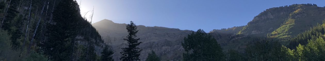
We arrived in Quito, the capitol of Ecuador on December 30. Quito sits at 9,350’ (2849 m), so we took our first day pretty easy, and walked from our hotel to the older part of town with historic churches and cathedrals. Walking up the many flights of stairs in the Basilica del Voto Nacional got my heart pumping and legs and lungs burning! New Year’s Eve in the La Mariscal area of Quito was quite entertaining and a little rowdy, with fireworks, burning of effigies, and jumping over the fires. Our first day hike was up Rucu Pichincha (15,413’, 4697 m), a stratovolcano right in Quito! The TeleferiQo (a gondola) brings you up to 12,943’ (3945 m) where you begin the hike. The hike up Rucu Pichincha starts out mellow, on smooth trail with short steep, punchy climbs. Once you near the top, the steepness increases and the last few hundred feet involve very easy scrambling on sharp volcanic rock. The winter in Ecuador is typically the rainy season, so scattered showers and electrical storms are very common. However, we lucked out with perfect weather on Rucu Pichincha, and fantastic views of the big mountains – Cotopaxi, Antisana, and Chimborazo. The next day we drove to the base of the Ilinizas, and just missed the horse that was supposed to carry our packs up to the refugio. It was about a 3,000’ (914 m) climb up to Refugio Nuevos Horizontes, in relentless wind and dense fog. About half way up to the refugio, a lone figure emerged out of the fog. The horse that was supposed to carry out gear was carefully making his way down the mountain, such a surreal sight! We spent the night sharing bunk beds, packed like sardines in the tiny refugio (15, 696’, 4784 m). The next morning, the wind hadn’t let up, and the fog was still suffocatingly thick. A few groups had attempted an early morning ascent of Iliniza Norte, but said it was too icy and windy to summit. Our mountain guide, Alejo, suggested we traverse around the backside of Iliniza Norte to avoid the worst of the wind, and his advice was on point. The wind was whipping so hard at the summit (16,818’, 5126 m), we spent less than 5 minutes on top before beginning our decent back to the car. The wind was so strong on our descent (upwards of 60mph!), it knocked me off my feet several times. Next time I will use my hiking poles when it is so windy! We spent the next day resting and recuperating at Los Mortinos Hacienda, a cozy B&B at the edge of Cotopaxi National Park where we watched llamas graze, went horseback riding, and dined on fresh trout from a nearby river.
The next day we drove up to the Cotopaxi parking lot, and slogged up the soft, ashy trail for an hour or so before reaching Refugio Jose Rivas (15,744’, 4798 m) at the base of Cotopaxi. At the refugio we ate some dinner, hydrated, and then tried to rest as much as possible. Alejo woke us up at 10pm and by 11pm we were on our way up the volcano. The skies were finally clear and calm after days of clouds and windy weather, all of the stars were out and we watched an impressive lightning storm down in Quito. We began the trek in mountaineering boots as the glacier starts about two hours uphill. While I felt fine the day before hiking up to the refugio, I had a pretty decent headache when we woke up. My right foot kept falling asleep in my mountaineering boot, and I was starting to overheat because I had too many layers on. This was the first time on the trip that I felt bad, and doubts about a successful summit started to creep in my mind. Alejo asked if I wanted to turn around, but even though I didn’t feel good, I didn’t feel bad enough to turn around. After about two hours of hiking, we reached the glacier and donned our crampons. And then I started to finally feel GOOD! As long as I kept switching my stepping technique, alternating between duck-footing, side-stepping, and French technique, my right foot wouldn’t fall asleep. The higher we climbed, the better I felt! About an hour away from the summit is when it really began to get steep. Alejo said it would be really steep, then a little easier, and then really steep again. We trudged on. And it got steep — really, REALLY steep. Just keep moving. Step up, rest, step up again, rest. Repeat. The mountain seemed to keep going up and up and up. But then around 8am we were at the top of Cotopaxi! I had seen photos of the summit, but seeing smoke coming out of the crater with my own eyes was mind-blowing. We ACTUALLY made it! We waited for Ian and his guide to summit, and then spent the better part of an hour taking photos and enjoying what Alejo said was the nicest weather he’d ever experienced at the summit.
Ian brought along an Accumed Pulse Oximeter, so being the science nerd that I am, I measured my oxygen saturation percentage at various elevations over the course of the trip. While the percentage of oxygen in the air is the same, the fall in atmospheric pressure at high altitude decreases the driving pressure for gas exchange in the lungs, leading to lower oxygen saturation levels. I measured my oxygen saturation level on my right index finger after being seated for approximately 5 minutes. The Accumed Pulse Oximeter is a small battery-powered device that measures the ratio of red light and infra-red light that is absorbed through the finger to calculate oxygen saturation levels.
Here is a table of my oxygen saturation levels at various elevations throughout the trip:
| Day | Location | Elevation (ft/m) | O2 saturation (%) |
| 1 | Quito | 9,350/2849 | 80 |
| 2 | Summit of Rucu Pichincha | 15,413/4697 | 75 |
| 3 | Refugio Nuevos Horizontes | 15, 696/4784 | 74 |
| 7 | Summit of Cotopaxi | 19,347/5896 | 57 |
Before reading too much into this very limited data set, there are a number of limitations with these observations I would like to point out. First, sample size is very limited, and I only took one reading at each elevation. Second, pocket pulse oximeters are not very accurate below oxygen saturation levels of 70%, and ambient light interference (as we experienced at the summits of Rucu Pichincha and Cotopaxi) can interfere with accuracy. Also, the literature suggests that pulse oximetry utility is limited in diagnosis of acute mountain sickness, and that measuring oxygen saturation after light exercise compared to rest may be more predictive of acute mountain sickness. I believe that I did not experience altitude sickness at any point during this trip. I had a mild headache after sleeping above 15,000’ (4572 m), but that resolved once we started hiking up the mountain. We stayed at the summit of Cotopaxi for approximately 1 hr, and while I had a slight headache and was day-dreaming (more than usual), I felt pretty good overall and had no problems on the descent. Pulse oximetry is painless and non-invasive, and can be a useful tool in evaluating respiratory and other complaints at high altitude, but care should be taken to minimize erroneous measurements to avoid misinterpreting the data.

Keshari Thakali, PhD is an Assistant Professor in the Department of Pediatrics at the University of Arkansas for Medical Sciences in Little Rock, AR. She is a cardiovascular pharmacologist by training and her research laboratory studies how maternal obesity during pregnancy programs cardiovascular disease in offspring. When not at work, you can find her mountain biking, rock climbing, hiking or paddling somewhere in The Natural State. She has a long-term career goal of merging her interests in mountaineering with studying cardiovascular adaptations at high altitude, and would appreciate any tips on how to accomplish this!

Reactive
Intelligent