
Category Archives: Mountaineering

Already an extreme sport, mountaineering at high altitudes adds exponential risk! Know before you go!

Wilderness Medicine & Medicine for our Wilderness

Our mission of advocacy and community building continues at our little mountain clinic as the aspen leaves have just begun to turn, and our passion for high altitude research has brought us to a unique and timely junction between the Wilderness Medicine Society‘s conference in Crested Butte, Colorado that Dr. Chris attended, and a recent conversation with the founder of The Sustainable Hiker, Summit County resident and voice of the Wilderness, Tom Koehler.

As health care providers in the high country, we see patients experiencing all kinds of reactions to the extreme altitude, residents and visitors alike. Even those who aren’t out climbing fourteeners or skiing can often experience symptoms of acute mountain sickness. Needless to say, we also see our share of injuries in the more adventurous outdoor-inclined. We ourselves make a point of regularly venturing out into the celebrated Colorado forests to experience this demanding environment first-hand, and it is not always without incident, in spite of our expertise and careful planning, and these past Spring and Summer seasons have been no exception, between hut trips, fourteeners, camping, kayaking, stand up paddle-boarding, cycling, lifting, yoga, and running at 9000′ and above! It is our due diligence and life’s work to share our experiences and the valuable research being done across the globe with you.

Dr. Chris and her contemporaries have returned from the Wilderness Medicine conference this year with some good and bad news. First, the good news:

Dr. Chris receives some impromptu wilderness medicine for a scrape on a recent trip to Harry Gates hut.
  1. There are no brown recluse spiders in Colorado, according to Kennon Heard, MD (although Dr. Chris’s sister-in-law disagreed with this expert’s statement).
  2. Most snake bites do not inject venom, so anti-venom treatment is only indicated if symptoms are noted. The anti-venom is very expensive, but treatment of the wound is important in order to control the cascade of events set off by the venom, starting with a diffuse reaction similar to a severe anaphylaxis, followed by neurotoxic fasciculations of muscles, along with a necrotizing wound causing pain and swelling at the site of the bite and ending in a full disruption of every clotting factor and cell in the body. The clotting disruption does not lead to hemorrhage. In layman’s terms, most snake bites aren’t shown to lead to symptoms, but should you experience any symptoms, things could escalate to life-and-death very quickly.
  3. Another useful talk was given by a specialist in foot care, Patrick Burns, MD, DiMM (Diploma in Mountain Medicine): He recommends wearing two pairs of acrylic socks and protecting areas of friction with paper tape. He rejected the ointments and gels as unproven. Don’t use duct tape, as it damages the skin, and moleskin tends to be too thick. Blisters should be left intact, although consider draining if pain is intense. Healing takes 120 hours.
  4. For accidents and injuries, studies show that irrigating wounds with water is as good as saline, and a well-filled Camel-bak makes an excellent splint for fractures. Pain was addressed by Alex Kranc, MD, FAWN (Fellow Academy of Wilderness Medicine): doses of acetaminophen 1000 mg and ibuprofen 400 mg or Naprosyn given together or alternately are as good as stronger prescription medicines in most cases. A system of acupuncture without needles that is light and compact has been shown to help with pain in combat situations (where, incidentally, many of these techniques and tools are developed). Think of a sticky patch that you apply to a pressure point behind your ears.
  5. Linda Keyes, MD discussed women at altitude, including some helpful tips for dealing with menstruation on wilderness treks: menstrual cups catch the flow and can be washed and used over again; taking the active birth control pills continuously will delay the onset of bleeding. Another piece of good news: bears (and sharks) are not attracted by menstrual blood.
  6. In a discussion about training for altitude events, Aaron Campbell, MD, MHS, DiMM, FAWM reviewed the role of sleeping in hyperbaric chambers or tents, which showed a mild improvement in adaptation. The best way to prepare for climbing Mt. Kilimanjaro, he said, is to climb a fourteener every week for 6 weeks!
A slide on improvising a Camel-bak bladder as a splint at the 2019 Wilderness Medicine conference in Crested Butte, Colorado.

The most exciting and spellbinding parts of the conference, according to Dr. Chris, were the descriptions of rescues from mountains, crevices, and ledges from Alaska to Boulder.

Now for the bad news:

Michael Loso, PhD gave a fascinating talk on the science of glaciology and water acquisition research in Alaska. Poo on the glacier gets buried and frozen, and lasts for years, if not decades, and they have even found traces of E. coli around certain base camps too high for drinking standards. This obviously can significantly compromise water quality, even at higher elevations, where we imagine the water from snowmelt is of the most pristine quality, a subject I also speculated about with Tom Koehler. This is why you should carry a proven filtration system. Tom’s preference, when possible, is an 8-minute boil.

Can you see the Rocky Mountain big horn sheep?

But what about the Wilderness itself? Colorado’s Continental Divide plays a major role in where our water goes, how it gets there, and in what condition. Sixty-eight percent of Colorado’s forests are federally owned and protected, one of the highest in the nation. With the continuing rise in residence and tourism, increased traffic through our precious forests is a double-edged sword.

“Summit County is really a microcosm, but an example of a larger issue facing Colorado: exponential growth, both in permanent population, as well as increase in guests to our land. So that, on a high level, has water managers scratching their heads, wondering, ‘How are we going to deliver the water we need for businesses and human health?’,” explains Koehler. “Summit is unique, particularly in the water issue, because we supply a significant amount of runoff into the Colorado River at the headwaters in Kremmling. And that arguably touches an estimated 40 million people all the way to California,” giving a rough estimate.

“A lot of Colorado is struggling to maintain their trails. We have about 430 miles of trails of all uses. In this county, we have a lot of trails to maintain, and arguably, that’s our first line of defense against erosion into our streams. It’s just a cascading effect (pardon the pun),” he says. “Most every park and forest in the West is under strain for maintenance. We just happen to be the most recreated, visited in the country, with 4.4 million recreational visits per year.”

Koehler’s passion for conservation and preservation of our forests and watershed was fostered in natural forests of Shenandoah Park, where he frequently escaped to while working as a research director for a wealth management firm in Washington, DC, while also dreaming of a career as a competitive skier in Park City, Utah.

“Once the opportunity arose to head out West with a couple of pennies in my pocket, I took it, and my move to Summit County was transformational in that I saw nature first-hand, right outside my door.” It transformed his outlook on how it benefits us all, even economically. He started volunteering with the Summit Huts Association, which provided him with “tremendous opportunity to really be in the backcountry”, the High Country Conservation Center, where he “really carved out an ethos for [himself] of stewardship”, and was even named the Friends of the Dillon Ranger District Volunteer Recruiter of the Year for 2015.

The Sustainable Hiker was founded as a response to recognizing that the efforts on a lot of fronts being made by organizations wasn’t as widely broadcast to both locals and guests. It’s mission: to be the leading voice for protecting Nature.

“I see the Sustainable Hiker as part of a number of organizations from the stewardship to the climate change advocacy groups to the local conservation groups, where you can find out what’s going on with your land and water here in Summit County.

“A healthier forest provides me with cleaner air and cleaner, more reliable water. It’s taken for granted. Kind of like a factory that turns out profits, it has to be maintained to continue yielding as high a profit.” Spoken like a true financier.
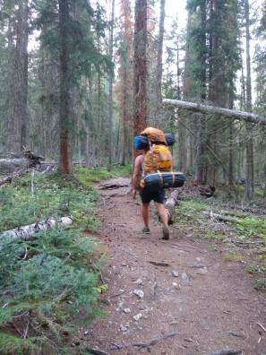
Setting off through the Eagle’s Nest Wilderness below Buffalo Mountain in Summit County, Colorado.

So what is one thing Colorado residents can do, immediately, to forward this movement of sustainability?

“Immediately, wherever you reside or are visiting, look at a nature or forest stewardship project, or educational events related to our forest or nature, and sign up.”

What is one thing we can stop doing that will contribute to the preservation and conservation of our forests and water?

“Stop, right now, taking nature for granted. Because we need it.

“Stop relying on your car for everything.

“Stop talking. In Nature … our time in Nature is a time to slow down everything, including our conversations. For two reasons: for the joy and peace we experience listening to the birds, and it gives the wildlife a break, too.”

Below treeline on the way up to Harvard and Columbia peaks outside of Buena Vista, Colorado.

I understand his point. While living in Japan, I learned a word, “shin-rin-yoku” (森林浴), literally translating to “forest bath”. The idea revolving around the practice is that by walking through the trees and water in the forest, you exchange ions with it, providing your body with a balancing recalibration. I believe this is also a vital part of high-altitude health.

The Sustainable Hiker provides insight into Koehler’s mission, at sustainablehiker.com, where you will also find information on organizations, events, and his newsletter, Nature’s Beacon, drawing attention to conservation projects you can get involved in.

robert-ebert-santos

Roberto Santos is from the remote island of Saipan, in the Commonwealth of the Northern Mariana Islands. He has since lived in Japan and the Hawaiian Islands, and has made Colorado his current home, where he is a web developer, musician, avid outdoorsman and prolific reader. When he is not developing applications and graphics, you can find him performing with the Denver Philharmonic Orchestra, snowboarding Vail or Keystone, soaking in hot springs, or reading non-fiction at a brewery.

Mt. Shavano & Tabeguache Peak

This past weekend, we ended Dr. Chris’s birthday week celebration with an ascent up Mt. Shavano, at 14,229′ (4337 m). We didn’t make it to the summit of the neighboring Tabeguache Peak, but I’m including it in the title of this piece because it was very much a part of our experience on this particular trek.

The standard summer route up Shavano and Tabeguache starts at 9700′, outside of the town of Salida. Up to the summit of Shavano, there is a 4400′ elevation gain over about 4.2 miles. If this is hard for you to imagine, know that it is formidable. Additionally, the trail increases in difficulty the further you progress, and the last .6 mile to the top is one of the most challenging ascents I’ve ever done without a heavy pack. In a previous article, I mentioned anticipating an inner dialogue about turning around before summiting. This inner dialogue didn’t involve me turning around so much as just passing out on a rock and staying there forever. But I did manage to summit after a 5.5 hr ascent, which included a 2-mile detour past and then back to the very first sign indicating the trail, in the dark of the early morning, at the very beginning of the hike. As obvious as the sign should have been, I’m relieved to say we weren’t the only ones.

This is the wooden sign indicating the Colorado Trail and the trail to reach Mt. Shavano and Tabeguache Peak.
The sign, .1 mi from the trailhead, that we somehow missed in the dark of the early morning.

And this is precisely why you should bring several resources to help guide you. In spite of all the trail descriptions with mileage that we brought, the only sure indication we had passed the turn-off from the Colorado Trail were the actual GPS coordinates of the sign listed in one of our resources (14ers.com). Pro tip: you can enter GPS coordinates into your Google Maps app (assuming you have service); leaving off the capital letters for cardinal directions (N, S, E, W), the first number will be latitude, the second longitude (in our case, we entered “38.60218, -106.19594” to find the sign we had initially passed).

Another learning experience on this particular trek was regarding our camp site. We had chosen the Angel of Shavano camp site, close to the trailhead, which is outside the town of Maysville, past Salida (about two hours from Frisco). The site is right at the foot of the mountains in that area, quite small (20 spots, first-come-first-serve, $20 per night for two vehicles). I was expecting a lot of other hikers, going to bed earlier than us, to wake up and start their ascent earlier than us, with more expensive, specialized gear, but was surprised to find all our neighbors partying until hours after we had retired into our tents.

Icing these puppies in a beautiful river along the Angel of Shavano campground.

As it turns out, there is a Winter route up Shavano, and the trailhead for the standard Summer route was about a 30-minute drive back toward Salida from the Angel of Shavano campground. So that explains why we didn’t encounter any other early-risers there. The good news is that Angel of Shavano campground is gorgeous, right off the Colorado Trail, along a beautiful river that, this late in the summer, was flowing shallow and slow enough that I could set a chair in it and soak my feet in the icy water (before putting them through hell the next day).

A half-moon over Angel of Shavano campground.

We ended up at the trailhead for the Summer route the next morning at 5:15 am. Pitch black. Here’s another pro tip: if your headlamp is dim, it needs new batteries.

Be aware that this parking lot is referred to as the “Blanks Trailhead Parking Lot” on signs on the trail, and this sign is the only one that reads “Mount Shavano Tabeguache Peak Trailhead”.

Other than missing what would have been a very obvious sign in the daylight, the rest of the trail was pretty much straight up. Even the switchbacks were steep enough to make me think, “Would it be much steeper if we just went straight up?” If you’ve ever climbed Peak One in the Ten Mile Range above Frisco, it’s like that (or any portion of that) times a hundred.

The dawn breaking as we backtrack toward the sign we missed.

It’s also significant to note that this was the second time in my life I’d ever wished for hiking poles. The steep grade had me pushing off my own thighs constantly as I trudged up the incline, and my quads were burning the entire hour-and-a-half it took me to get back down. Yes: 5.5 hours up, 1.5 hours down.

The water in my Camel-bak was all I’d brought on the trail (after drinking from a couple Nalgene bottles I’d brought in the car), and I ran out just before getting back to the trailhead. One of us ran out of water in her Camel-bak on her way up to the summit. Fortunately, another one of us had packed an extra gallon of water.

As far as snacking went, we had plenty of jerky, pistachios, bananas, nut butter, and electrolytes between us. I may even have had a chocolate-covered Twinkie. But we didn’t finish all of that, and as I’d expected, my body didn’t really crave food so much as liquids, until I’d reached the end of the hike, at which point I promptly finished all traces of food in the car.

Dr. Chris taking a break on the saddle below the summit of Shavano.

All-in-all, I’d say that was a successful excursion, and even the mistakes we made affirmed that even experienced hikers should take extra care. My main takeaway: don’t rush the start of the trail. It is worth hours to be sure where you are headed, even if it means standing in one spot, double-checking all your resources, entering GPS coordinates for 20 minutes.

The treacherous terrain up the last .6 mi to the summit of Mt. Shavano.

Also notable: we started back on the right track toward the beginning of the hike just before 7 am, at which point it was already bright out, and I reached the summit at 11 am. By 11:15, all the distant clouds had amassed into huge thunderheads, and the first rumble of thunder had us packing up pretty quickly. And this isn’t the first time I’ve seen this. No matter how far away you think those clouds are, it takes mere minutes for them to travel. And as white and interspersed as clouds may seem, they can collect into large, grey, stormy masses very quickly. So, beer in hand, I started a quick descent from the peak. I’d already run for my life down a fourteener in a lightning storm once, and I don’t ever plan to do that again. Furthermore, the summit area of Mt. Shavano is little more than a huge pile of rough boulders, a type of terrain requiring your hands as well as your feet to navigate, called talus. The trail is neither clear nor safe, and there is no way you are running down it.

Do you see a trail here?
Neither did we.

Finally, the weather was the main reason we didn’t make it to the neighboring Tabeguache Peak. A local we talked to on the trail who had made the ascent numerous times advised us to budget at least an hour each way to and from Tabeguache. It’s only about a mile away, but it’s a rocky, narrow ridge. And sure enough, on our way down, it started hailing along with the thunder (and in my experience with fourteeners this time of year, it always does), rained lightly twice through the forest, and then poured torrential rain toward the bottom of the trail.

Would I recommend this trek? Definitely. It is a true test of fitness, and even more so, stamina. As with any other trek, and as I always strongly advise, be wise and pre-emptive about how far and how fast you go. Elevations above 8,000′ are when your body’s reaction to the altitude become exponentially more dramatic, so you can bet elevations above 10,000′ put you at much higher risk for all kinds of symptoms of altitude illness. The faster you ascend, the greater the risk. And remember, our party set out well before daylight at 5:30 am. In the future, should I plan to summit both of these beasts, I would certainly start no later than 4 am.

Other than that, do your homework and prepare accordingly, and you’ll be in for the time of your fitness-challenging, self-motivated lives! Happy Trails!

Beer and jerky time, 5.5 hours later, atop Mt. Shavano at 14,229′.
robert-ebert-santos
Roberto Santos on an epic powder day at the opening of The Beavers lift at Arapahoe Basin ski area.

Roberto Santos is from the remote island of Saipan, in the Commonwealth of the Northern Mariana Islands. He has since lived in Japan and the Hawaiian Islands, and has made Colorado his current home, where he is a web developer, musician, avid outdoorsman and prolific reader. When he is not developing applications and graphics, you can find him performing with the Denver Philharmonic Orchestra, snowboarding Vail or Keystone, soaking in hot springs, or reading non-fiction at a brewery.

Climbing a Fourteener: An Insider’s Abridged Guide

Some of your friends have done one or two and a couple are on their way to having ascended their 20-something-eth peak over 14,000 ft. You’ve heard the views are breathtaking, the sense of accomplishment is riveting, and it makes you that much more secure in calling yourself a Coloradan.

Climbing fourteeners has become a popular quest for so many residents and visitors to Colorado, and as I prepare to take on another one myself, I thought I’d share my process of preparation for anyone looking for insight. There are a lot of very practical guides out there, everything from maps to trail descriptions. Hopefully, what I have to tell you is some less-than-obvious, experience-driven advice.

Every fourteener is different. Elevation in itself is a poor indicator of the level of difficulty of any trail. Mt. Evans, at 14,265 ft. (4348 m.), has a paved road all the way up to the top. Mt. Princeton at 14,196 ft. (4327 m.) took me several hours to hike and I was on all-fours to climb any set of stairs the next few days.

Oops …..

Access is everything. I mentioned there are ample resources out there, including regularly updated printed literature as well as online accounts. Take it from me: read them all. Many of these peaks have several approaches, and trails sometimes intersect. The difference may be hours! Some friends and I set out to climb Mt. Harvard (14,423 ft., 4396 m.), in the Collegiate Peaks outside Buena Vista. When we got to the top (after a few hours of hiking), the small cardboard sign tucked under some rocks read “Mt. Columbia 14,078′” (4291 m.)”. Imagine our surprise.

You can’t always rely on your phone, either, so take maps, print out trail descriptions (including any of trails you don’t plan to take), and check them often during your ascent.

Timing. Timing, timing, timing, timing, timing. You may have heard this already, and any Coloradan will tell you that no matter how clear, sunny and calm the first part of the day is, the weather can change in an instant. Even if it remains calm at the base of a 14er, these high peaks will rake in the clouds. Shortly after we summited Mt. Columbia (as in, within five minutes), we noticed some grey clouds in the distance. Then we started to hear the crackling of static all around us. Then lightning. Then we proceeded to run all the way down that rocky mountain questioning every decision we’d ever made. During the 30 or 40 minutes of very dangerous running and leaping back down to the tree-line (an ascent that took us hours), all I could think was, “So this is how it ends. My family won’t even find out for days.” Luckily we made it down, and my companions couldn’t tell I was crying because we were soaking wet from rain and hail.

Start early. Before dawn if possible. I’m not exaggerating.

Anticipate every climate. There is often still snow on Colorado’s highest peaks, even at the height of summer heat. You will be sweating all the way up, but as soon as you stop to rest, the biting wind toward the summit will prompt you to unpack every layer you shoved into your tiny Camel-bak.

Pay attention to distance and elevation gain. Ascending 2000 ft. in 8 miles is a vastly different experience than ascending 2000 ft. in 4 miles. If you can’t imagine what either of these feels like, definitely try some lower summits before attempting a 14er. Peak One, just over Frisco, in the Ten Mile Range summits at 12,933 ft. (3942 m.), but the elevation gain is almost 4000 ft. in less than 5 miles. I’ve done this hike several times, and I always, always find myself debating whether it is totally necessary that I reach the top.

This weekend, I’ll be headed up Mt. Shavano at 14,299 ft. (4337 m.), outside of Salida. It’s a 4600-ft. gain over almost 5 miles, so this tells me I’ll be having that inner dialogue about turning back early at least a couple times on my way to the summit. It’s been 95 degrees (F) at 7000 ft. during the day recently, so that tells me I’ll be in all my layers, including a hooded jacket when we set out on the trailhead before daylight, I’ll strip all the way down to shorts when the sun rises after an hour or two, then put it all back on when we reach the top.

One piece of advice on water and snacks: lots of water, lots of snacks. I very personally prefer to give my body some extra calories the night before we set out on the trail, and I don’t expect to consume a lot of weight on my way up. However, as soon as I’ve reached the top and all I have to worry about is the (often less-intensive) descent, my muscles start craving nutrition and hydration.

Remember, turning around is always an option. If someone in your party is struggling or the weather looks like it will be taking a turn for the worse, don’t wait until it’s too late to head back to safety. These mountains aren’t going anywhere fast. Other than the above-mentioned, maybe lesser-known details, don’t forget the usual: sun protection, sturdy and comfortable shoes, some basic first aid, and a plan to maintain communication with those in your party.

If you’ve had any close calls hiking fourteeners in Colorado or any additional wisdom you’d like to pass on, please do share them in the comments! In the meantime, stay tuned for a follow up on our Mt. Shavano ascent, and Happy Trails!

robert-ebert-santos
Roberto Santos on an epic powder day at the opening of The Beavers lift at Arapahoe Basin ski area.

Roberto Santos is from the remote island of Saipan, in the Commonwealth of the Northern Mariana Islands. He has since lived in Japan and the Hawaiian Islands, and has made Colorado his current home, where he is a web developer, musician, avid outdoorsman and prolific reader. When he is not developing applications and graphics, you can find him performing with the Denver Philharmonic Orchestra, snowboarding Vail or Keystone, soaking in hot springs, or reading non-fiction at a brewery.

Accessibility at Altitude

How accessible are the places you go?

This past weekend, volunteers from Ebert Family Clinic in Frisco teamed up with the Northwest Colorado Center for Independence for No Barriers, a non-profit program that, among other impactful things, works to empower people with disabilities and bring communities face-to-face with what it means to be accessible.

This particular program, called “What’s Your Everest?“, takes place every year at various outdoor venues, connecting people with all sorts of disabilities with their ropes teams who assist them in ascending literal mountains. This year, held at Arapahoe Basin on the Continental Divide, participants navigated narrow, single-track trails over large rocks, through forest, up increasingly steep inclines to reach a summit well over 12,000′ (3657 m).

Volunteers and organizations across the state contributed to this weekend’s success, including STARS, Steamboat Adaptive Recreational Sports, providing a fleet of adaptive equipment to facilitate the ascent.

Some of the adaptive equipment provided at the No Barriers hike at Arapahoe Basin: we saw people on all kinds of apparatuses from hiking poles to one-wheelers to three-wheelers equipped with every kind of pedaling, wheeling, steering and braking device!

I imagine most people associate accessibility with wheelchair access in a restaurant, braille menus, audio signaling at crosswalks, ASL interpreters … this is just the tip of the iceberg. I promise you have never seen gear like adaptive equipment, and even if you have, you haven’t seen all of it.

How do you navigate a wheelchair up a mountain when it’s wider than the trail?

How do you operate or steer a wheelchair if you cannot grip the wheels or handles?

How do you navigate a trail without sight?

One of a fleet of adaptive cycles used for our No Barriers ascent and descent of Arapahoe Basin ski area. This particular apparatus allows the user to steer using pressure against a chest pad while “pedaling” with their hands. You can’t brake while using your hands to pedal!

None of this is easy, and even the current adaptive equipment has inherent flaws. It’s important to recognize that each person’s disability is unique, and can’t always be compensated by the same equipment produced for the next person.

Our ropes team with Leo in a wheelchair engineered for off-road ascents. Handles in the back for pushing, a handle inside either wheel for moving the wheels, steering and braking — but what if your disability prevents you from gripping the handles??

How do you start thinking about accessibility?

Accessibility is about cost. Adaptive equipment is expensive. Custom-making a recumbent bicycle that allows you to pedal without the use of your legs or feet is thousands of dollars, and people who need this equipment to partake in activities everyone without a disability enjoys should not have to pay more for being disabled.

Accessibility is about comfort. After volunteering at this year’s annual Colorado Youth Leadership Forum, where young adults with disabilities are empowered and educated about advocating for themselves and living independently, I realized you cannot expect people to stay focused and engaged in your programming if the room is too hot or the provided meal is unfulfilling. If someone without a disability is distracted by the temperature, you can be sure the attention of someone with autism is long-gone.

Accessibility is about time. Whatever expectations you apply to the amount of time someone needs to put clothes on, eat, use the bathroom, speak a sentence – forget all about it. People with disabilities often need more time. If someone needs more time in the bathroom or walking/wheeling to a destination, adjust your expectations and wait. Your impatience and intolerance is not improving access.

Two teams taking a break half-way up to Black Mountain Lodge at Arapahoe Basin ski area, after navigating some of the narrowest portions of the trail.

Accessibility is about language. Learn sign language. It is just as much a part of our culture as spoken English and Spanish. People with hearing impairments often learn to read lips because they are taught that their hearing counterparts can’t be bothered to learn a form of communication other than one spoken language. And this isn’t just about being deaf. Having a disability sometimes means you have a speech impediment, or that your brain doesn’t organize thought and speech the same way others do. Communicating effectively takes all forms for all disabilities: physical, mental and emotional.

Northwest Colorado Center for Independent Living (NWCCI) Independent Living Coordinator Carlos Santos hauling down the mountain at Arapahoe Basin ski area on an adaptive cycle after making his ascent to over 12,000′ on foot with hiking poles.

Accessibility is about attitude. Sometimes, people with certain disabilities can be very loud and blunt. Sometimes, they can walk, but with a limp. Sometimes, they speak very slowly. This does not mean they are rude, drunk, can’t think for themselves or can’t express their own opinions. Accommodating these situations means being prepared to shift your expectations and perspective.

I’ve been scolded by people sitting behind me at an opera for whispering translations to my blind companion next to me, before headsets with translations were provided. I’ve helped my friend into an outdoor trash elevator to get from the street level to a downstairs bar. And there was still a step onto the elevator platform. I’ve witnessed someone being thrown out of a bar for being “too intoxicated”, when in reality, he was just paraplegic and walked with a limp. And how is someone in a wheelchair supposed to use a port-a-potty at an outdoor music festival?

Is this the best we can do?

Our indoor establishments are barely held to any minimum standard of accessibility. Why are we doing so poorly, and why does access stop when it comes to the outdoors?

Ebert Family Clinic’s team, Medicina Para Montañeros, ascending the final 100 meters at Arapahoe Basin.

I continue to learn more and more about what it means for any particular event, establishment, activity or location to be truly accessible and inclusive, and it is important to me that my friends and family with disabilities are able to partake in the same experiences that I enjoy. I’ve realized that recommending a place that is “accessible” depends a lot on the disabilities present. Determining whether or not someone in a wheelchair can navigate a trail depends on what kind of wheelchair they are in as well as the grade and width of the trail.

12,500′ after hours of hiking, pushing, pulling, wheeling, carrying our way up to the top of Arapahoe Basin, discovering that ‘what is inside us is truly stronger than what is in our way’.

Accessibility is about problem-solving. It is up to all of us as a community to find solutions that enable our friends and family with disabilities to interact as freely with our environment as those of us without disabilities, both indoor and out. I encourage anyone and everyone to start with a simple visual assessment: take a look around you, next time you are on a hike, in a brewery, by the lake, at the farmer’s market, at your favorite coffee shop and ask yourself if your disabled counterparts would be able to join you. Start there.

robert-ebert-santos
Roberto Santos on an epic powder day at the opening of The Beavers lift at Arapahoe Basin ski area.

Roberto Santos is from the remote island of Saipan, in the Commonwealth of the Northern Mariana Islands. He has since lived in Japan and the Hawaiian Islands, and has made Colorado his current home, where he is a web developer, musician, avid outdoorsman and prolific reader. When he is not developing applications and graphics, you can find him performing with the Denver Philharmonic Orchestra, snowboarding Vail or Keystone, soaking in hot springs, or reading non-fiction at a brewery.

What’s Going On in La Paz?

The 7th Chronic Hypoxia Symposium was held this year in La Paz, Bolivia, in February and March. La Paz, sitting at 11,942 ft. (3640 m), is home to one of the world’s leading researchers of the effects of chronic hypoxia, Dr. Gustavo Zubieta-Calleja, with whom Colorado’s own Dr. Christine Ebert-Santos was able to meet with during her attendance of the symposium. You can refer to her previous article on the gathering of experts from over 16 countries for her own account of Dr. Zubieta-Calleja’s impressive work.

Below is the renowned Dr. Sanjay Gupta’s own account on video of his introduction to the experience of hypoxia and altitude with Dr. Zubieta-Calleja.

Always keep in mind, there are many physiological reactions going on when your body and brain are at altitude, and the higher the altitude, the more extreme the effects. Benefitting from a hypoxic environment isn’t as simple as staying hydrated. When we talk about chronic hypoxia, we are typically referring to a population who have spent many years in a high altitude environment.

robert-ebert-santos
Roberto Santos on an epic powder day at the opening of The Beavers lift at Arapahoe Basin ski area.

Roberto Santos is from the remote island of Saipan, in the Commonwealth of the Northern Mariana Islands. He has since lived in Japan and the Hawaiian Islands, and has made Colorado his current home, where he is a web developer, musician, avid outdoorsman and prolific reader. When he is not developing applications and graphics, you can find him performing with the Denver Philharmonic Orchestra, snowboarding Vail or Keystone, soaking in hot springs, or reading non-fiction at a brewery.

Coloradans on the Annapurna Circuit

One of our nearest and dearest, Shelbie Ebert, a certifiable high country local born at Vail Valley Hospital, has been an adventure guide for the last decade. She is currently working on her nursing degree, and is an Emergency Medical Technician. While she has done some multi-day backpacking in the past, she says her recent trip to Nepal was her “most ambitious journey to date.” I was able to sit down with her and her mother, Karen, and hear all about the literal ups and downs on the Annapurna Circuit, in the central mountain region of Nepal, where they reached the highest point at 17,769 ft (5416 m)! They were in Nepal from April 17th to May 17th.

This trek is of international fame, and there are many resources to inform those looking to embark on this historical, spiritual, mental, and physical adventure. All in all, they spent 14 days on the trail. But I was so curious what it was like for those more familiar with the unique challenges posed by Colorado’s high altitude environment.

Did you do anything different from others you observed on the trail?

Most people had porters; we decided not to do that. Even those who didn’t have porters hired a guide.

Having been born and raised at a higher elevation than most, did you notice a difference between your own process of acclimation and that of your colleagues?

I did get sick in Nepal, but it was mostly stomach sickness. No headaches or anything like that. Mom didn’t feel a headache until we got pretty high up. We noticed a lot of people dropping; a lot of people bused into Manang, and from there, it’s a two-day hike up to the base camp, and from there you cross the pass. They got on the trail from there. Manang is at about 10,000 ft. Those people definitely struggled more. 

A father and son hiked the trail side-by-side with us. They didn’t hire porters. Shortly after we got over [Thorung La Pass], the son got really, really sick. The pass tops out at about 17,200 ft. When we saw him at the top of the pass, his lips were bright blue. I think he started to get sick on the ascent. I think he was probably about my age, and he was a doctor. He had some drugs stocked up and he felt pretty confident about doing the hike. 

They started their hike at about 2600 ft. above sea level. In a matter of 10 days, they would climb to over 17,000 ft. over 70 miles.

How long did you take before you started hiking?

We flew into Kathmandu, spent two days there, then took a long bus to the city where we started hiking, and we started hiking as soon as we got off the bus. We did take an acclimation day in Manang, at 10,000 ft. We hiked to it, then we spent an extra day there, about 48 hours. 

What was the greatest challenge about this excursion?

How much constant up and down it was, with the altitude gain. The day that we went over the pass it felt like a good day to me, because it resembled hiking in Colorado. But those days of up and down prepared us well for the pass. 

Did you do any training in particular in preparation for this excursion?

No, absolutely not. I read a lot of blogs so I knew what to expect. I tried to have just a really good plan for what we could and couldn’t do, and when we got to Kathmandu, I stocked up on all kinds of drugs, because anyone can buy them. Diamox. I think I maybe only took one once on our ascension day, just to get ahead of the game. 

Did you change or adjust your diet at all to prepare for this excursion?

I thought I did. I looked up some Nepali food online and tried cooking it at home to prepare my stomach for the type of food that we would be eating, but I found it was nothing like actual Nepali lentils and rice. 

Learned some hard lessons about food. A lot of the lentils in Nepal made me sick. Luckily they have a lot of potato-based dishes. 

[There was a] surprising amount of good snacks available, [lots of pre-packaged cashews, nuts, cookies and snacks]. I would recommend for anybody to bring five or six cliff bars for the harder days.

Also kept some sugar on me: Snickers, chocolate, gummies … I forced Karen to eat some sugar when she wasn’t feeling well, and that seemed to improve her condition.

Karen did experience some symptoms of altitude sickness as they ascended the highest point of the trek, Thorung La.

In retrospect, is there anything you would have done differently in preparation and/or on the trail?

I would have packed a lot less. We had about 35 – 40 lbs. in our bags, and that was way too much — and totally unnecessary. Less is more on the trail. We did end up hiring a porter to carry my mom’s pack on our big day, and that was an excellent decision. 

Did you notice anything different upon your return to a much lower elevation?

I felt really strong! I was really grateful for my body. I think it was mostly a mental shift. I felt more capable doing most activities, whether it was mental or not. I started taking better care of myself. I started running in the mornings before school, which is something I never would have felt before. 

I thought, “I hiked 17,000 ft, I can probably run a mile and be okay in the morning.”

Any other advice you’d give in particular to other travelers intent on similar excursions?

You know what, go for it! It’s not as hard as you think. I came to a country I’d never been to before with a book in my hand, and we did it! I think anybody can really do it.

Shelbie is honored to have shared this experience with her wonderful, strong mother. And this isn’t the first or last adventure they will have been on together. True backcountry buffs, I can always find them on all types of gear on the snow, on the river, or on the trail.

Shelbie and Karen victorious at the height of Thorung La Pass.

If you’d like to read more details about their Annapurna Circuit Trek, Shelbie maintains a blog where you can find all kinds of tips and recommendations on backcountry gear at lahlahdesigns.com.

robert-ebert-santos
Roberto Santos on an epic powder day at the opening of The Beavers lift at Arapahoe Basin ski area.

Roberto Santos is from the remote island of Saipan, in the Commonwealth of the Northern Mariana Islands. He has since lived in Japan and the Hawaiian Islands, and has made Colorado his current home, where he is a web developer, musician, avid outdoorsman and prolific reader. When he is not developing applications and graphics, you can find him performing with the Denver Philharmonic Orchestra, snowboarding Vail or Keystone, soaking in hot springs, or reading non-fiction at a brewery.


Muscle Atrophy in Visitors at High Altitude

As many as 30 million people travel to the mountains in the western United States each year1 to enjoy the beauty and outdoor activities the terrain has to offer. Travelers may worry about altitude sickness upon arrival. However, another important side effect of high altitude exists: muscle atrophy. While it may not be noticeable during visitors’ short time at high altitude, it is still a remarkable effect the elevation has on human bodies.

Muscle atrophy is a scientific term for the loss of muscle mass2; essentially, the muscle fibers shrink due to loss of important contractile proteins and organelles, which are essential parts of muscle fibers3. This means that the muscle won’t be able to perform as well4, especially in terms of endurance and power; tasks that are normally easy, such as walking up a flight of stairs, may be significantly more tiresome or difficult.

An elevation is considered high altitude when the location is 2400 meters or more above sea level4. This is about 7,874 feet of elevation. Over 140 million people worldwide live at or above this altitude4, making the issue of altitude-induced muscle atrophy very relevant to many. 

Hypobaric hypoxia, which occurs at high altitudes, is a decreased barometric pressure in addition to a decrease in oxygen availability1. This is a double whammy for visitors for two reasons: a lower pressure won’t be able to push as much oxygen into tissues, and less availability of oxygen will diminish the amount that tissues receive1. These two conditions result in less oxygen getting to body systems1 that usually obtain a good amount. This is especially pertinent to muscles because of their prevalence in the human body.

Muscle atrophy is indicative of a disproportion between the process that builds protein and the process that breaks down protein in muscles2. Several studies have shown that when muscles receive less oxygen, such as in hypobaric hypoxic states, muscle protein degradation is boosted while muscle protein creation dwindles2,3,4,5. This results in an overall deficit of protein in the muscle, which is meaningful because muscles store the most protein compared to any other organ in the body3.

Currently there are no official guidelines for prevention of muscle atrophy due to hypobaric hypoxia. There are also no medications that currently counteract the loss of muscle3, although researchers are now turning their focus to ways of maintaining the balance of protein breakdown and building in muscle. 

Despite the fact that these measures are suggested for preventing high altitude illness, it may be beneficial in general to stay hydrated, ascend slowly to altitude, eat a balanced diet, and remain active1. Foods and herbal supplements rich in antioxidants may be helpful in preventing muscle wasting during exposure to hypobaric hypoxia4, although there is no direct evidence to support this theory yet. Overall, it would be beneficial to maintain good nutrition throughout the visit to the mountains. Moderate exercise may help visitors acclimatize, although overly spirited exercise can cause other altitude-related problems1.

How are people who live at altitude affected by muscle atrophy? At the moment, studies are geared more towards the effects that altitude has on people who visit from lower elevations. Once the body has acclimated to the altitude, oxygen utilization and distribution will improve greatly and will ensure that tissues receive more oxygen1. This may explain why people who live at high altitude for long periods of time are able to maintain and oftentimes increase their muscle mass. Even so, people who live at high altitude should still eat a healthy diet and drink a good amount of water to make sure their bodies can function optimally.

It is important to be aware of the side effects that altitude has on the bodies of sea-level visitors. There is still more research to be done regarding effective treatment options for this particular type of muscle atrophy. Knowing that high altitude causes muscle atrophy can help people be aware of their activity level and diet and may modify how people choose to ascend to the mountains. This consequence of high altitude should not prevent people from enjoying all that mountainous regions have to offer.

Grace Barrett is a Physician Assistant student at the University of St. Francis in Albuquerque, New Mexico. Born and raised in Grand Rapids, Michigan, Grace attended Michigan State University where she received degrees in both Physiology and Spanish. After completing her rotation in pediatrics with Dr. Chris, Grace will have rotations in New Mexico, Michigan, and California before graduating in April 2020. She is hoping to explore urology as her elective rotation. Grace enjoys baking cookies, being active, watching Chopped on the Food Network, spending time with family, and planning her wedding (in August 2020). 

References

1. Gallagher SA, Hackett P, Rosen JM. High altitude illness: Physiology, risk factors, and general prevention. UpToDate. https://www.uptodate.com/contents/high-altitude-illness-physiology-risk-factors-and-general-prevention. Published September 20, 2017. Accessed July 18, 2019.

2. McKinnell IW, Rudnicki MA. Molecular Mechanisms of Muscle Atrophy. Cell Press. 2004;119:907-910.

3. Bonaldo P, Sandri M. Cellular and molecular mechanisms of muscle atrophy. Disease Models & Mechanisms. 2013;6(1):25-39. doi:10.1242/dmm.010389.

4. Rathor R, Suryakumar G. Muscle Atrophy at High Altitude. Journal of Clinical and Molecular Endocrinology. 2016;1(3):1-2. doi:10.21767/2572-5432.10018.

5. Chaudhary P, Suryakumar G, Prasad R, Singh SN, Ali S, Ilavazhagan G. Effect of acute hypobaric hypoxia on skeletal muscle protein turnover. Al Ameen Journal of Medical Science. 2012;5(4):355-361.

Altitude and the Brain

Our brain is a highly demanding organ that requires a constant supply of oxygen, evidenced by how quickly a drowning victim loses consciousness. But apart from being under water, many other places on Earth expose our brains to the low oxygen levels that cause hypoxia, or lack of oxygenated blood flow to the brain. The most common of these places is that of high altitude (current studies in the US often define this as above 8,000 ft.). But how does long-term exposure to the low oxygen levels in these environments affect our brains?  Recent studies have revealed new dangers from exposure to extremely high altitudes (15,000+ ft.), and they suggest that our brains also feel the impact at less extreme elevations as well. As concerning as these findings may be, further studies are being done to increase our knowledge of these effects and luckily, methods to prevent and avoid them do exist. But in order to avoid them effectively, we must first understand the dangers that high altitude presents. 

Extremely high altitude locations are some of the most impressive and breath-taking places in the world. They often serve as bucket list checkpoints for travelers and mountaineers everywhere.  However, in a 2006 study by Fayed et al, a new risk for extremely high altitude hikers (15,000 ft+) was revealed1. MRI scans were performed on the brains of those returning from locations including Mt. Everest, Mt. Aconcagua, Mont Blanc and Mt. Kilimanjaro1.  Shockingly, almost every Mt. Everest climber returned with brain changes on their MRI scans. They revealed cortical atrophy and enlargement of their Virchow-Robin spaces, processes that are usually associated with aging1. The amateur of the group seemed to suffer the most permanent changes with subcortical lesions as well1. Where there had been one unaffected hiker in the Everest group, none returned from the Aconcagua expedition without brain changes. Four hikers also showed subcortical lesions1. Unfortunately, and even more concerning, most of these changes were still present on MRI scans several years afterward as well1

A follow up study in 2015 by Kottke et al. examined mountaineers before and after a 7,126m (23,373ft) ascent and found that none had subcortical lesions afterward2. However, there were increases in cerebral spinal fluid fractions and decreases in white matter fractions in several of the hikers. They also took it a step further and related it to the hypoxic levels and mountain sickness symptoms that the individuals suffered and were able to correlate these episodes with more significant brain changes2

More research must be done to determine what these brain changes mean and how they will impact the lives of these individuals later in life. However, researchers have also found ways to approach altitude that seemed to lessen these effects. The number one suggestion that professionals share to prevent the possibility of permanent brain changes is simple; ascend slowly1. The studies that found permanent brain changes in extreme altitude hikers seemed to find worsened effects in the amateurs that ascended too quickly versus the professionals that had ascended correctly, over time1. Oxygen supplementation and other methods to prevent acute mountain sickness during the climbs seemed to help as well1

For those of us that refrain from scaling some of the world’s tallest mountains, but frequently visit or reside in moderately high altitudes, our brains can also be affected.  Abrupt elevations in altitude from a low level environment have been shown to affect people’s memory storage and recall3. It has also caused impairments in concentration, aphasia and finger tapping speed temporarily3. In a 2016 study that examined young, healthy individuals living at altitudes of 3650 m (11,975 ft) for a minimum of three years, significant impairments in attention were revealed4. Early and late stages of attentional processes were impacted in this study group when compared with a control group4. These impairments were also made more significant when larger amounts of perceptual input, or distractions, were added4

In terms of the long-term high altitude group, attention span data did show impairment in early and late stages, but interestingly, changes in brain activation on brain scans were proposed as possible mechanisms to attempt to compensate for this4. Moreover, it was also found that later stages of attentional processes showed less brain activation in the high altitude group, but they found that this discrepancy lessened the longer that the individual lived at altitude, suggesting adaptation was occuring4

Rather than residing at moderately high altitudes, traveling to them can also affect the brain. The same advice of ascending slowly at extremely high altitudes is also applicable here. Giving the body time for appropriate acclimatization is key to preventing any physical symptoms as well as any confusion, sluggish thinking, or difficulty concentrating and focusing1. Proper hydration, nutrition and the occasional oxygen supplementation can lessen symptoms as well. 

In conclusion, more research is needed to study the effects of permanent brain changes from extremely high altitudes as well as to determine if there really is a danger toward our attention spans, or any other cognitive processes, from living at high altitude. Although it is important to be aware of these risks, very few residents and adventurers let it hold them back from visiting and living in some of the most incredible places in the world. As long as we approach with an understanding of the dangers, prepare appropriately and always ascend slowly, not even our brains can hold us back from the adventures to be had in these amazing locations. 

Jenna Bradfield is a Physician Assistant Student at the University of St. Francis in Albuquerque, New Mexico. Prior to PA school, she completed her undergraduate studies at Southern Utah University where she played collegiate volleyball as well. She is currently completing her third clinical rotation in Pediatrics at the Ebert Family Clinic. As she is originally from a small town in Utah, she has and will be completing several more rotations in her home state along with other rotations in New Mexico and Texas. She grew up loving the outdoors and sports, and also enjoys physical fitness, music, reading and spending time with friends and family.

References:

1: Fayed, N., Modrego, P. and Morales, H Evidence of brain damage after high-altitude climbing by means of magnetic resonance imaging. American Journal of Medicine. 2006. 119, 168.e1-168.e6. 

2: Kottke, R. Hefti, JP. Rummel, C. Hauf, M. Hefti, U. Merz, TM. Morphological brain changes after climbing to extreme altitudes – a prospective cohort study. PLoS One. 2015; 10(10): e0141097

3: Hombein, TF. Long term effects of high altitude on brain function. Int J Sports Med. 1992;(13) Supple 1:S43-5. 

4: Wang, Y. Ma, H. Fu, S. Guo, S. Yang, X. Luo, P. Han, B Long-term exposure to high altitude affects voluntary spatial attention at early and late processing stages. Scientific Reports. 2014; (4) 4443.

Spring Recap 2019

We’ve learned a lot in the high country this season! For example, it isn’t too late or too warm for a snowstorm. We’ve conducted several interviews with professional, high-altitude athletes, athletic and tourism organizations in Summit County, physicians, podcasters, interns, and a local brewer. They’ve shed so much light on fitness, health, child growth & development, and acclimation at elevation, it warrants a re-cap:

  1. 8,000 ft. seems to be the pivotal elevation at which the body starts to experience a significant deficit in the oxygen and water it needs to function, affecting everything from sleep to metabolism.
  2. A plant-based lifestyle has benefitted athletes under extreme training and competitive conditions at altitude.
  3. Training at altitude significantly reduces your ability to reach cardiovascular and strength goals, even while preparing your respiratory and circulatory systems for the severe decrease in oxygen. “Live High, Train Low” is an effective strategy more and more athletes are advocating for.
  4. Preparation for backcountry excursions is as much mental as physical.
  5. Foods high in nitrates (like red beets, red bell peppers and arugula) can facilitate acclimation and recovery.
  6. Oily foods may inhibit your body’s ability to cope with a significant increase in altitude.
  7. We metabolize and experience the effects of alcohol differently at altitude.
  8. Current research suggests some people suffering from Parkinsons disease may experience some relieve from symptoms at higher elevation.
  9. Increased muscle mass requires increased oxygen. Being an athlete does not necessarily mean you will have an easier time acclimating.
  10. As always, the best way to facilitate acclimation and deal with symptoms of altitude sickness is to drink plenty of water, allow yourself ample rest, and monitor your blood oxygen saturation levels with a pulse oximeter.

Be sure to subscribe to keep up with what this summer has in store for your elevated experiences at altitude! And if you have any questions or are eager to read more about a particular topic, let us know in a comment!

Metabolism at Altitude : Preventing Acute Mountain Illness through Strategic Nutrition

Last September, my friend and I decided to go camping. We chose an area close to Silverthorne, Colorado (9,035 ft.) and decided to camp above tree line at around 11,000 feet. Both of us were endurance athletes and had done camping trips at altitude many times without complications. We considered ourselves in great shape and ready for any adventure. 

We departed from our home in Fort Collins (5,003 ft.) in the morning and arrived at the trailhead before noon. We were well prepared and had plenty of nutrition in our 40+ lb.-backpacks. The start of the trailhead was at 9,035 ft and we had to hike 7 miles to our destination at 11,000 ft. We were well hydrated, built our camp and went to bed. Both of us had mild edema to our extremities, but nothing that we were worried about as we had experienced these symptoms on multiple hikes to higher elevations in the past. 

We spent the next day hiking above tree line, staying hydrated and fueling with high-quality calories. We have learned from personal experience to eat even when we do not feel like it. We both have experienced weight loss of about 5-10 lbs. per week when camping and hiking above 10,000 ft. 

We did a 7-mile exploratory hike along the ridge line at 11,000 ft. the next day, again, staying hydrated and consuming plenty of calories. We returned to camp when my partner first mentioned a mild pounding headache. He drank more fluids, had dinner and went to bed. 

Rewarding views, in a tent at altitude!

I woke up at around midnight due to my partner running out of the tent. He vomited once and returned to the tent. Something else seemed off. He did not zip the tent door shut when he returned. He mumbled that his head was hurting and kept his head elevated as it relieved the pain to some degree. A few hours later, he vomited again. 

The next morning I proposed that we should pack up camp and hike down the mountain, as he continued to complain of a pounding headache. He refused and wanted to go hike some more. I left the tent site first, walked a few steps and turned around: he was sitting down, staring at the ground. Now I started to really get worried as he was an amazing endurance athlete with a never-ending hunger for adventure. This was not like him. 

I decided to pack up the tent, whether he liked it or not. We needed to get off the mountain before his condition worsened. 

After many attempts, I was finally able to convince him to come with me, and we started our descent. Between 11,000 ft. and 9,000 ft. we walked slow, as his coordination was slightly limited. As soon as we reached 9,000 ft., he started to improve: he started to walk faster, was more coordinated, and communicated more. By the time we got back to our car, he was back to his normal self, however he still had a lingering headache. 

The effects of altitude on his body were very surprising. He demonstrated some classic symptoms of what the high altitude medical community refer to as “HACE”, High Altitude Cerebral Edema: headache, vomiting, confusion, and ataxia (a loss of control of body movement). The experience was unexpected and scary. Cell phone reception is very limited in the backcountry and if his condition would have worsened, this trip could have ended in a very bad situation. 

Summit County, Colorado is a beautiful place to explore the outdoors, hiking and camping. I recently had a conversation with an avid outdoorsman who calls Fort Collins (4,982 ft.) his home and enjoys hiking and camping in Summit County at elevations ranging from 9,000 ft – 12,000 ft. He stated that he consistently experiences unwanted weight reduction of around 5-10 lbs. in body weight per week when living in the backcountry at elevations above 9,000 ft.

Is this weight loss related to increased activity without adjusting calorie intake? Could this weight loss be related to exposure to higher elevation and possible changes in metabolism? How can one keep track of calorie-cost and anticipate the inevitable stress on the body at altitude?

Compare your activity level

A GPS or even a pedometer can help measure and compare activity. An increase in miles or steps compared to baseline may require caloric adjustment in order to prevent weight loss. Calorie input should equal calorie expenditure in order to prevent weight loss. It is important to take into consideration that hiking in the mountains usually requires a high level of physical performance due to elevation gain and loss as well as walking on uneven surfaces which result in increased muscle recruitment.

Increased basal metabolic rate (BMR)

According to Dünnwald et al. (2019), exposure to higher altitude increases BMR initially as the body is adapting to the hypoxic environment. The study concluded that increased sympathetic activity and hypoxia may be responsible for the increase in BMR. Due to more extreme exposure to elements such as cold, wind, rain and snow, involuntary shivering may also contribute to an increase in calorie expenditure and should be considered when preparing for the backcountry.

Decrease in appetite

Another factor contributing to possible weight loss may be related to a lack in appetite. Research on the cause of high altitude anorexia is ongoing, however some researchers believe there may be a correlation between a change in appetite-stimulating hormones at altitude. A study by Shukla et al. (2005) found a decrease in total levels of the appetite-stimulating hormone ghrelin, peptide YY, glucagon-like peptide-1, and leptin at initial exposure to altitude. Pre-packaging and scheduling meals while hiking at altitude may aide in the prevention of weight loss during backcountry activities.

Muscle atrophy

Chaudhary et al. (2012) propose that changes in protein turnover in hypoxic environments may be related to muscle wasting, including a decrease in protein synthesis and an increase in protein degradation. To minimize muscle atrophy, it is important to consume high protein foods frequently. Amino acids may also aide in protein synthesis. Packing snacks with high nutritional value can prevent weight loss. Nutrition labels on food items are a great way to identify optimal snacks.  

Hiking in the backcountry on a multi-day trip requires preparation. I choose high-calorie foods that taste good, are light to pack, and have minimal waste. I make breakfast and dehydrated meals at home and put them into individual bags that only require me to add water. Making your own dehydrated meals allows you to avoid unnecessary additives. I supplement throughout the day with high calorie snacks. If I have room in my pack, I also add what I call “novelty” backcountry foods, such as cheese and wine – it is important to splurge every once in a while, even if you live in a tent. 

Great foods for the back country:

  • Butter or Coconut Oil coffee: many companies make pre-packaged individual coffee. One cup of butter coffee is around 200 calories.
  • Perfect Bars: 1 Bar has around 300 calories and 17 grams of protein. 
  • Pro Bars: 1 Bar has 390 calories, they are light to pack and taste great.
  • Nuts and seeds: easy to pack, great source of healthy fats, calories and protein
  • Jerky: we make our own elk jerky. It is a great snack throughout the day with healthy protein and added salt. 
  • Apples: It is difficult to get fresh fruit in the back country. Apples are easy to pack, last for a long time and allow you to get vitamins and fiber. 
  • Dehydrated fruits and vegetables: great addition to oatmeal in the morning and your dinner at night. Dehydrated fruits and vegetables are easy to make at home, very light to pack, and you can rehydrate them in the backcountry. 
  • Oatmeal with protein powder: we pre-package oatmeal with dehydrated fruit and a scoop of our favorite protein powder in individual bags. Just add water and you have a fantastic-tasting and calorie-rich breakfast. 

Every backcountry excursion should be well planned and it is always better to be over-prepared. It is crucial to be knowledgeable about what foods need to be consumed and when, in order to prevent negative outcomes. Know the distance and elevation changes on your trip, prepare for changes in weather, plan your calories out for every meal on every day, and make a schedule to prevent complications related to nutrition. 

Most importantly: enjoy the beauty of the high-elevation backcountry!

Angi Axmann Grabinger is Nurse Practitioner student at the University of Northern Colorado. Angi’s passion in healthcare involves disease prevention and integrative medicine. If Angi is not studying, working or gardening, you can find her exploring the mountains running or hiking. 

References

Chaudhary, P., Suryakumar, G., Prasad, R., Singh, S.N., Ali, S., Ilavazhagan, G. (2012). 

Chronic hypobaric hypoxia mediated skeletal muscle atrophy: role of ubiquitin–proteasome pathway and calpains. Retrieved from: https://link.springer.com/article/10.1007%2Fs11010-011-1210-x

Dünnwald, T., Gatterer, H., Faulhaber, M., Arvandi, M., Schobersberger, W. (2019). Body 

Composition and Body Weight Changes at Different Altitude Levels: A Systematic Review and Meta-Analysis. Retrieved from:https://www.frontiersin.org/articles/10.3389/fphys.2019.00430/full

Shukla, V., Singh, S.N., Vats P., Singh, V.K. , Singh, S.B., Banerjee, P.K. (2005).  Ghrelin and 

leptin levels of sojourners and acclimatized lowlanders at high altitude. Retrieved from: https://www.ncbi.nlm.nih.gov/pubmed/16117183